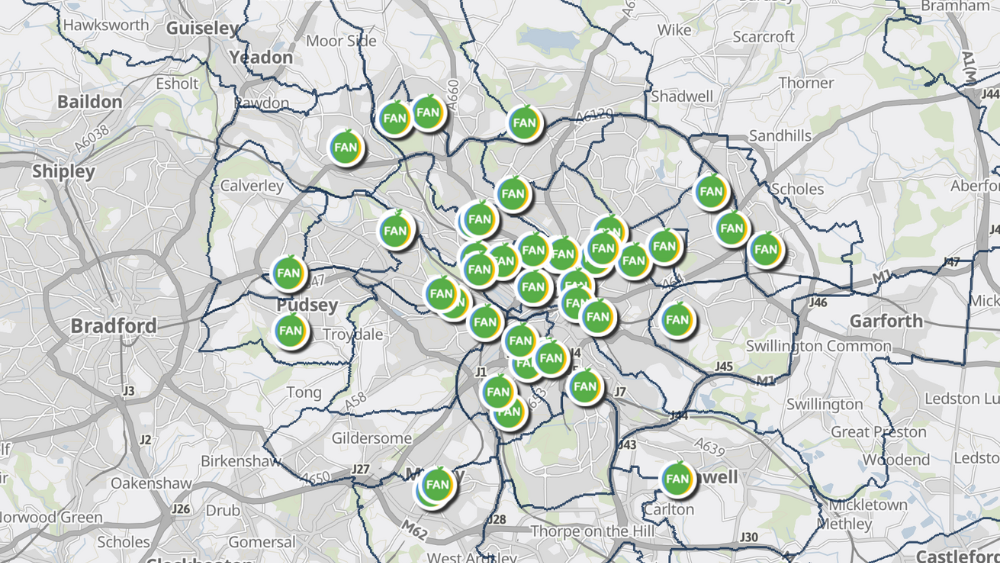
Leeds Food Aid Network (FAN) and Leeds City Council have published a new Food Aid Provision Map of Leeds.
Direct link to Find Food Aid Provision in Leeds – ArcGIS Interactive Map
The resource has been significantly developed and much-improved. Features include:
For Food Aid Providers:
- New streamlined application form
- Ability to create, manage and update your own listings
- Option to choose (and change) whether your provision is viewable publicly
- Updated provision types and categories to support effective signposting by frontline staff and agencies
For Map Users:
- Ability to search by provision type as well as location
- New functions to make it easier for users to identify the most appropriate provision
- Location photographs included as well as the postal address, to make access easier for visitors
- Clearer information about types of provision and support available
The map and further information can be found on the Leeds Food Aid Network website.
Join the map
If you are a food provider you can register your food aid provision on the map by filling in the map application form here.
The form takes approximately 10-12 minutes to complete and can be accessed on a computer or mobile device or via the QR Code below:
For organisations already signed up – if anything has changed or you would like to add/edit any of your details you can do so by using the link provided when you first signed up. If you are unable to locate that email, please contact [email protected].
FAN hope the food provision map will continue to be a useful tool and in addition to improvements for map users. The aim of the new version is also to help providers to share good practice and collaborative working, particularly those working in close proximity. Leeds Food Aid Network and partners will now also have access to analysis tools linked to the map, enabling greater understanding of food aid provisions in the city.
If you have any questions or comments about using the map please contact [email protected] or [email protected].
